First stop: food! We stopped by a little local 'pub and grub' place hoping to catch the end of the race (Sunday afternoon). The layout was very odd, but, we didn't have much time, so, stuck with it. Connie went to the restroom, and I went to the bar. I first confused the bartender by ordering two beers....at the bar..
bartender: your waitress will bring them out, where are you sitting?
me: ummm...right here.
bartender: don't you have a table?
me: no
bartender: Oh, well, you can seat yourself.
me: I'm sitting here..."she" (pointing at the empty stool next to me) went to the restroom.
bartender: (lightbulb goes off) Oh, ok.
After getting that squared away, I asked if he can change the TV behind the bar to the race...he'll have to get someone.... I ask this of 3 employees, no one knows how to change the channel!!! Finally, between myself, Connie, and another guy at the bar, we convince one to try. She screwed up the other TV's in the bar, but, gets the channel changed on ours just minutes after the race ended. The whole ordeal took about 20 minutes. Unreal!!!!
Anyway, after downing a couple of beers and some food, we headed further South to Bell Smith Springs in the Shawnee National Forrest. During the process of deciding where to go, I reviewed pictures and descriptions of several locations in the area, and decided that this would be a good place to visit with only a little time to invest. I printed a map of the trails and directions to get there....you know, just in case. :-) First, I missed the turn I was supposed to take to be on the correct state highway. I didn't realize it was right as you exited the Interstate!! No big deal...we'll just take this highway that will intersect with the one we're supposed to be on about 10 miles up the road. Back on track, we follow the directions which has mileage included. The signs that you normally expect to see directing you to state/federal parks or local tourist info were sparse at best. We get about 2 miles from where the directions tell us to turn and I see a street named something that makes me think I should turn here. Sitting in the middle of the intersection (a 'T' in a gravel road) looking confused, a guy in a truck stops to ask if we're lost. I ask him how to get to Bell Smith Springs (straight or left) and he confirms that I *am* supposed to turn left here. So, the mileage is wrong on the map, and only sign we saw, and the road names are not the same. What an adventure, and we've not even got where we're going yet!!!
So, we turn left, and follow the road to our destination. It took a bit to get oriented and understand the map and the corresponding trail (it was a topographic map with only a general outline of the trail). But, we eventually got comfortable with where we were headed.
That evening yielded a few nice pictures.
This formation is called Devil's Backbone:


After some more exploration, it started to get fairly dark and we decide it's time to leave. We make our way out and start heading back to the highway to find a hotel. The nearest hotel is about 20 miles away in Harrisburg.
As we pull in to town, we find that the whole South end of town is without power. Traffic lights, businesses...everything. At one intersection, there's a cop with a flashlight directing traffic. We make our way to the other end of town (where there is power) and get checked in (at least this time, they didn't look at me like a psycho when I asked if they had Internet access). We get everything hauled up to the room and I decide to go pick up some beer (all that hiking you know)! I return about 15 minutes later with 2 bottles of water. It turns out that they only sell alcohol on Sundays from noon - 7:00pm, but, Shawneetown about 20 miles up the road sells until 8:00pm (it's about 8:30). That just doesn't make much sense to me. I can understand if you have an ordinance to not sell alcohol on Sunday at all, or even not before noon is fairly common (we're talking the bible belt, here, folks!). But, to cut off sales at 7:00pm???!!! I just don't get that one!! So, anyway, we enjoy the water and look at pictures / watch some football to pass the time.
Monday morning, we pack up, grab some breakfast, and get ready to head back to Bell Smith Springs. Except, when I saw the interstate, I knew something had gone wrong. How did I miss the first sign.....and the town that has a pass-through to the correct road???!!! I must really be out of it!! So, we stop at the Casey's just off the Interstate and turn back. I passed a sign that I thought said something about it, hit the brakes. and read the one from the other direction, and sure enough, it was pointing me to Bell Smith Springs!! I am a terribly slow reader, and can't read signs from a distance, and just didn't read fast enough the first time through. Then I figured out what happened.....I was supposed to turn at the edge of town (where the power was out the night before). So, we're back on track now, winding through roads - some of which are actually on the map, and see a sign pointing to a lookout tower called Trigg Tower.
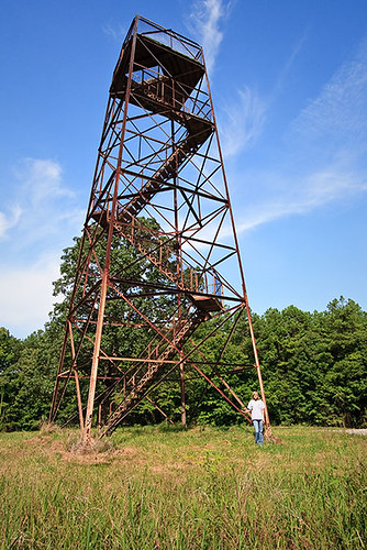
Hmmm....I've heard of that...wanna go check it out? Sure! We head down yet another gravel road. Several miles later, we see a tower. It isn't marked in any way, other than a small parking lot that also serves as access to a horse trail (hitching posts and all). Honestly, I wasn't sure that was it. I really expected a sign or some sort of posting identifying it. But, after searching flickr later, it turns out that yes, it is in fact, Trigg Tower.
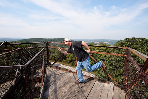
We took several pictures, both on top and from the ground.
Phooning on top of Trigg Tower:
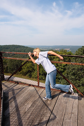
After leaving there, we headed back towards Bell Smith Springs. As we headed back, we saw a sign pointing out some other local points of interest. We never found them. There were no further signs or directions. I guess you just gotta wander the gravel roads until you see a trail. Of course, some of the area isn't far from "Deliverance" territory, so, wondering around the woods in an unknown area may not end up being a good idea. heh! Everyone I've ever met down there seems pretty friendly, but, there's a lot of hillbilly potential. Anyway, since we didn't get distracted any more, we finally made it to Bell Smith Springs!! We walked the other direction from what we explored on Sunday night. But, first, you have to descend the stone stairs.
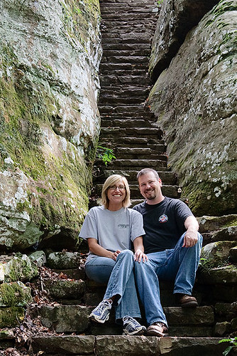
The one thing I had seen pictures of (some better than others) was called 'Natural Arch', so, that's what our destination is. As we headed to the trail, we stopped to look and take pictures several times. This is where we crossed the spring:
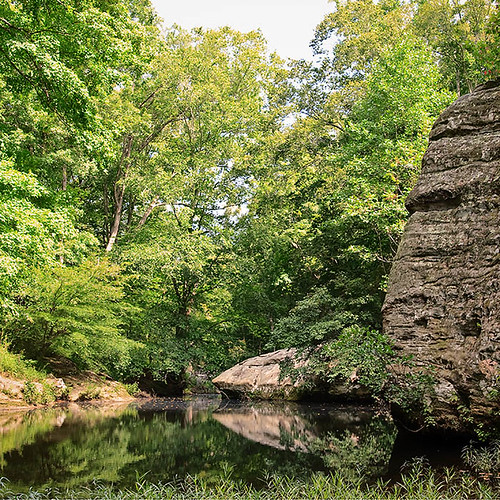
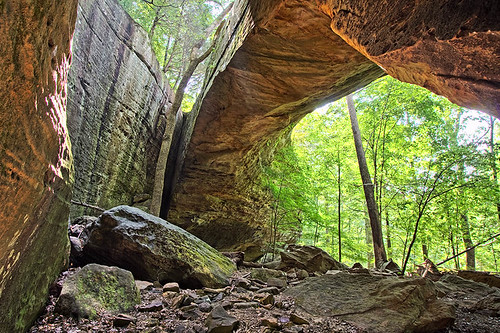
We finally made it to the Natural Arch. This is the largest natural bridge in the Shawnee National Forest.
This is the view from below:
After this, we decided it was time to head back. It was much easier finding my way out. I don't think I got lost once!!! There is still much of Bell Smith Springs that I didn't make it to. One of these days, I'll have to go back and see more of this small park.


1 comment:
Wow, looks like you guys had a great time!
Nice pictures!
Post a Comment